Say Leyte et unaan ya klase a luyag ed rehiyon na Eastern Visayas, Filipinas. Unong ed 1 Mayo 2020 census, say populasyon to et 1,776,847 totoo tan 402,126 abong. Walay kabaleg tan sukat to ya 6,313.33 sq. km. Say kodigo telefono +63 (0)53. Say kapital to et Tacloban.
| Leyte |
|---|
|
Luyag na Filipinas |
 |

Laylay | 
Selyo | |
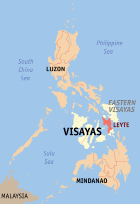
Lokasyon na Leyte |
 |
|
11°0′0″N 124°51′0″E |
| Dalin |
Filipinas |
|---|
| Angipaletnegan |
1735 |
|---|
| Kabesera |
Tacloban |
|---|
| Barangay |
1641 |
|---|
| Gobiyerno |
|---|
| • Pangulo |
Leopoldo Dominico Petilla |
|---|
| Kaawang |
|---|
| • Katiponan |
6,313.33 km2 (2,437.59 sq mi) |
|---|
| Bilang na too (Mayo 1, 2020)[1] |
|---|
| • Katiponan |
1,776,847 |
|---|
| • Densidad |
280/km2 (730/sq mi) |
|---|
| Economia |
|---|
| • Clase |
unaan ya klase a luyag |
|---|
| • Ingresos |
₱3,255,205,295.13 (2020) |
|---|
| • Activos |
₱14,784,010,305.75 (2020) |
|---|
| • Pasivos |
₱2,778,067,933.27 (2020) |
|---|
| • Gastos |
₱1,961,900,955.83 (2020) |
|---|
| Kodigo na postal |
6500–6542 |
|---|
| Kodigo na lugar |
53 |
|---|
| Website |
leyteprovince.net |
|---|
Saray siyudad tan baley
dumaen
- Tacloban
- Baybay
- Ormoc
- Abuyog
- Alangalang
- Albuera
- Babatngon
- Barugo
- Bato
- Burauen
- Calubian
- Capoocan
- Carigara
- Dagami
- Dulag
- Hilongos
- Hindang
- Inopacan
- Isabel
- Jaro
- Javier
- Julita
- Kananga
- La Paz
- Leyte
- MacArthur
- Mahaplag
- Matag-ob
- Matalom
- Mayorga
- Merida
- Palo
- Palompon
- Pastrana
- San Isidro
- San Miguel
- Santa Fe
- Tabango
- Tabontabon
- Tanauan
- Tolosa
- Tunga
- Villaba
Sensus na populasyon ed
Leyte| Taon | Pop. | ±% p.a. |
|---|
| 1903 | 294,892 | — |
|---|
| 1918 | 440,328 | +2.71% |
|---|
| 1939 | 688,934 | +2.15% |
|---|
| 1948 | 751,649 | +0.97% |
|---|
| 1960 | 876,079 | +1.28% |
|---|
| 1970 | 1,020,128 | +1.53% |
|---|
| 1975 | 1,099,848 | +1.52% |
|---|
| 1980 | 1,191,227 | +1.61% |
|---|
| 1990 | 1,367,816 | +1.39% |
|---|
| 1995 | 1,511,251 | +1.89% |
|---|
| 2000 | 1,592,336 | +1.13% |
|---|
| 2007 | 1,724,240 | +1.10% |
|---|
| 2010 | 1,567,984 | −3.40% |
|---|
| 2015 | 1,724,679 | +1.83% |
|---|
| 2020 | 1,776,847 | +0.59% |
|---|
| Reperensiya: Philippine Statistics Authority[2][3][4] |


