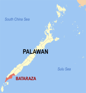
Bataraza
Baley na Pilipinas ed luyag na Palawan
Page Module:Infobox/styles.css has no content.
| Bataraza | |
|---|---|
| Baley na Filipinas | |
 Lokasyon na Bataraza | |
 | |
| 8°40′12″N 117°37′12″E | |
| Dalin | Filipinas |
| Angipaletnegan | Enero 1, 1964 |
| Barangay | 22 |
| Kaawang | |
| • Katiponan | 726.20 km2 (280.39 sq mi) |
| Elebasyon | 55 m (180 ft) |
| Bilang na too (Mayo 1, 2020)[1] | |
| • Katiponan | 85,439 |
| • Densidad | 120/km2 (300/sq mi) |
| Economia | |
| • Clase | unaan ya klase ya baley |
| • Ingresos | ₱483,360,953.46 (2020) |
| • Activos | ₱1,722,931,619.12 (2020) |
| • Pasivos | ₱370,903,622.45 (2020) |
| • Gastos | ₱381,879,848.88 (2020) |
| Kodigo na postal | 5306 |
| Kodigo na lugar | 48 |
Say Bataraza et unaan ya klase ya baley ed luyag na Palawan, Filipinas. Unong ed 1 Mayo 2020 census, say populasyon to et 85,439 totoo tan 21,294 abong. Walay kabaleg tan sukat to ya 726.20 sq. km. Say zip code to et 5306.
Saray barangay
dumaen- Bono-Bono
- Bulalacao
- Buliluyan
- Culandanum
- Igang-Igang
- Inogbong
- Iwahig
- Malihud
- Malitub
- Marangas (Poblacion)
- Ocayan
- Puring
- Rio Tuba
- Sandoval
- Sapa
- Sarong
- Sumbiling
- Tabud
- Tagnato
- Tagolango
- Taratak
- Tarusan
Demograpiko
dumaen| Taon | Pop. | ±% p.a. |
|---|---|---|
| 1970 | 10,176 | — |
| 1975 | 15,510 | +8.82% |
| 1980 | 17,973 | +2.99% |
| 1990 | 29,142 | +4.95% |
| 1995 | 33,303 | +2.53% |
| 2000 | 41,458 | +4.81% |
| 2007 | 53,430 | +3.56% |
| 2010 | 63,644 | +6.57% |
| 2015 | 75,468 | +3.30% |
| 2020 | 85,439 | +2.47% |
| Reperensiya: Philippine Statistics Authority[2][3][4] | ||
Saray reperensiya
dumaen- ↑ "2020 Census of Population and Housing (2020 CPH) Population Counts Declared Official by the President". Hulyo 7, 2021. https://psa.gov.ph/content/2020-census-population-and-housing-2020-cph-population-counts-declared-official-president.
- ↑ Census of Population (2015). "Region IV-B (Mimaropa)". Total Population by Province, City, Municipality and Barangay. PSA. Retrieved 29 June 2016.
- ↑ Census of Population and Housing (2010). "Region IV-B (Mimaropa)". Total Population by Province, City, Municipality and Barangay. NSO. Retrieved 29 June 2016.
- ↑ Censuses of Population (1903–2007). "Region IV-B (Mimaropa)". Table 1. Population Enumerated in Various Censuses by Province/Highly Urbanized City: 1903 to 2007. NSO.
Saray gawing ed labas
dumaen