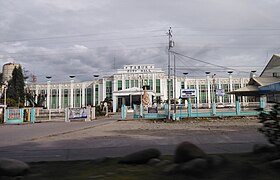
Tabuk
Siyudad na Pilipinas ed luyag na Kalinga
Page Module:Infobox/styles.css has no content.
| Tabuk | |
|---|---|
| Siyudad | |
 | |
 Lokasyon na Tabuk | |
 | |
| 17°24′25″N 121°26′33″E | |
| Dalin | Filipinas |
| Angipaletnegan | Hunyo 16, 1950 |
| Barangay | 43 |
| Kaawang | |
| • Katiponan | 700.25 km2 (270.37 sq mi) |
| Elebasyon | 293 m (961 ft) |
| Bilang na too (Mayo 1, 2020)[1] | |
| • Katiponan | 121,033 |
| • Densidad | 170/km2 (450/sq mi) |
| Economia | |
| • Clase | kumalima ya klase a siyudad |
| • Ingresos | ₱1,186,416,281.24 (2020) |
| • Activos | ₱2,840,749,738.13 (2020) |
| • Pasivos | ₱390,898,150.83 (2020) |
| • Gastos | ₱1,005,536,046.99 (2020) |
| Kodigo na postal | 3800 |
| Kodigo na lugar | 74 |
| Website | www |
Say Tabuk et kumalima ya klase a siyudad ed luyag na Kalinga, Filipinas. Unong ed 1 Mayo 2020 census, say populasyon to et 121,033 totoo tan 25,731 abong. Walay kabaleg tan sukat to ya 700.25 sq. km. Say zip code to et 3800.
Saray barangay
dumaenSay Tabuk walay 42 ya barangay.
- Agbannawag
- Amlao
- Appas
- Bagumbayan
- Balawag
- Balong
- Bantay
- Bulanao
- Bulanao Norte
- Cabaritan
- Cabaruan
- Calaccad
- Calanan
- Dilag
- Dupag
- Gobgob
- Guilayon
- Ipil
- Lanna
- Laya East
- Laya West
- Lucog
- Magnao
- Magsaysay
- Malalao
- Masablang
- Nambaran
- Nambucayan
- Naneng
- Dagupan Centro (Pob.)
- San Juan
- Suyang
- Tuga
- Bado Dangwa
- Bulo
- Casigayan
- Cudal
- Dagupan Weste
- Lacnog
- Malin-awa
- New Tanglag
- San Julian
Demograpiko
dumaen| Taon | Pop. | ±% p.a. |
|---|---|---|
| 1918 | 4,079 | — |
| 1939 | 3,343 | −0.94% |
| 1948 | 7,376 | +9.19% |
| 1960 | 21,261 | +9.22% |
| 1970 | 28,016 | +2.79% |
| 1975 | 33,918 | +3.91% |
| 1980 | 42,768 | +4.74% |
| 1990 | 57,200 | +2.95% |
| 1995 | 63,507 | +1.98% |
| 2000 | 78,633 | +4.69% |
| 2007 | 87,912 | +1.55% |
| 2010 | 103,912 | +6.27% |
| 2015 | 110,642 | +1.20% |
| 2020 | 121,033 | +1.78% |
| Reperensiya: Philippine Statistics Authority[2][3][4] | ||
Saray reperensiya
dumaen- ↑ "2020 Census of Population and Housing (2020 CPH) Population Counts Declared Official by the President". Hulyo 7, 2021. https://psa.gov.ph/content/2020-census-population-and-housing-2020-cph-population-counts-declared-official-president.
- ↑ Census of Population (2015). "Cordillera Administrative Region (CAR)". Total Population by Province, City, Municipality and Barangay. PSA. Retrieved 29 June 2016.
- ↑ Census of Population and Housing (2010). "Cordillera Administrative Region (CAR)". Total Population by Province, City, Municipality and Barangay. NSO. Retrieved 29 June 2016.
- ↑ Censuses of Population (1903–2007). "Cordillera Administrative Region (CAR)". Table 1. Population Enumerated in Various Censuses by Province/Highly Urbanized City: 1903 to 2007. NSO.