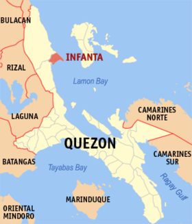
Infanta, Quezon
Baley na Pilipinas ed luyag na Quezon
Page Module:Infobox/styles.css has no content.
| Infanta | |
|---|---|
| Baley na Filipinas | |
 | |
 Lokasyon na Infanta | |
 | |
| 14°44′33″N 121°38′58″E | |
| Dalin | Filipinas |
| Angipaletnegan | Abril 25, 1696 |
| Barangay | 36 |
| Kaawang | |
| • Katiponan | 342.76 km2 (132.34 sq mi) |
| Bilang na too (Mayo 1, 2020)[1] | |
| • Katiponan | 76,186 |
| • Densidad | 220/km2 (580/sq mi) |
| Economia | |
| • Clase | unaan ya klase ya baley |
| • Ingresos | ₱375,909,209.82 (2022) |
| • Activos | ₱924,947,785.77 (2022) |
| • Pasivos | ₱83,257,835.24 (2022) |
| • Gastos | ₱196,204,831.70 (2022) |
| Kodigo na postal | 4336 |
| Kodigo na lugar | 42 |
| Website | www |
Say Infanta et unaan ya klase ya baley ed luyag na Quezon, Filipinas. Unong ed 1 Mayo 2020 census, say populasyon to et 76,186 totoo tan 19,125 abong. Walay kabaleg tan sukat to ya 342.76 sq. km. Say zip code to et 4336.
Saray barangay
dumaen- Poblacion 1
- Poblacion 38
- Poblacion 39
- Poblacion Bantilan
- Comon
- Ingas
- Dinahican
- Alitas
- Langgas
- Anibong
- Balobo
- Bacong
- Magsaysay
- Amolongin
- Pulo
- Binonoan
- Gumian
- Tongohin
- Pinaglapatan
- Ilog
- Catambungan
- Pilaway
- Agos Agos
- Banugao
- Miswa
- Lual
- Batican
- Boboin
- Libjo
- Abiawin
- Binulasan
- Maypulot
- Silangan
- Cawaynin
- Antikin
- Tudturan
Demograpiko
dumaen| Taon | Pop. | ±% p.a. |
|---|---|---|
| 1903 | 10,283 | — |
| 1918 | 15,860 | +2.93% |
| 1939 | 20,331 | +1.19% |
| 1948 | 19,006 | −0.75% |
| 1960 | 21,868 | +1.18% |
| 1970 | 21,653 | −0.10% |
| 1975 | 25,271 | +3.15% |
| 1980 | 27,814 | +1.94% |
| 1990 | 35,564 | +2.49% |
| 1995 | 39,772 | +2.12% |
| 2000 | 50,992 | +5.47% |
| 2007 | 60,346 | +2.35% |
| 2010 | 64,818 | +2.64% |
| 2015 | 69,079 | +1.22% |
| 2020 | 76,186 | +1.94% |
| Reperensiya: Philippine Statistics Authority[2][3][4] | ||
Saray reperensiya
dumaen- ↑ "2020 Census of Population and Housing (2020 CPH) Population Counts Declared Official by the President". Hulyo 7, 2021. https://psa.gov.ph/content/2020-census-population-and-housing-2020-cph-population-counts-declared-official-president.
- ↑ Census of Population (2015). "Region IV-A (Calabarzon)". Total Population by Province, City, Municipality and Barangay. PSA. Retrieved 29 June 2016.
- ↑ Census of Population and Housing (2010). "Region IV-A (Calabarzon)". Total Population by Province, City, Municipality and Barangay. NSO. Retrieved 29 June 2016.
- ↑ Censuses of Population (1903–2007). "Region IV-A (Calabarzon)". Table 1. Population Enumerated in Various Censuses by Province/Highly Urbanized City: 1903 to 2007. NSO.