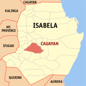
Cauayan
Siyudad na Pilipinas ed luyag na Isabela
Page Module:Infobox/styles.css has no content.
| Cauayan | |
|---|---|
| Siyudad | |
 | |
 Lokasyon na Cauayan | |
 | |
| 16°46′12″N 121°46′48″E | |
| Dalin | Filipinas |
| Angipaletnegan | 1740 |
| Barangay | 65 |
| Kaawang | |
| • Katiponan | 336.40 km2 (129.88 sq mi) |
| Elebasyon | 65 m (213 ft) |
| Bilang na too (Mayo 1, 2020)[1] | |
| • Katiponan | 143,403 |
| • Densidad | 430/km2 (1,100/sq mi) |
| Economia | |
| • Clase | kumatlo ya klase a siyudad |
| • Ingresos | ₱1,102,696,177.49 (2020) |
| • Activos | ₱1,911,828,458.47 (2020) |
| • Pasivos | ₱1,091,498,149.22 (2020) |
| • Gastos | ₱1,037,367,806.93 (2020) |
| Kodigo na postal | 3305 |
| Kodigo na lugar | 78 |
| Website | cityofcauayan |
Say Cauayan et kumatlo ya klase a siyudad ed luyag na Isabela, Filipinas. Unong ed 1 Mayo 2020 census, say populasyon to et 143,403 totoo tan 36,399 abong. Walay kabaleg tan sukat to ya 336.40 sq. km. Say zip code to et 3305.
Saray barangay
dumaen- Alicaocao
- Alinam
- Amobocan
- Andarayan
- Bacolod
- Baringin Norte
- Baringin Sur
- Buena Suerte
- Bugallon
- Buyon
- Cabaruan
- Cabugao
- Carabatan Chica
- Carabatan Grande
- Carabatan Punta
- Carabatan Bacareno
- Casalatan
- San Pablo (Casap Hacienda)
- Cassap Fuera
- Catalina
- Culalabat
- Dabburab
- De Vera
- Dianao
- Disimuray
- District I (Pob.)
- District II (Pob.)
- District III (Pob.)
- Duminit
- Faustino (Sipay)
- Gagabutan
- Gappal
- Guayabal
- Labinab
- Linglingay
- Mabantad
- Maligaya
- Manaoag
- Marabulig I
- Marabulig II
- Minante I
- Minante II
- Nagcampegan
- Naganacan
- Nagrumbuan
- Nungnungan I
- Nungnungan II
- Pinoma
- Rizal
- Rogus
- San Antonio
- San Fermin
- San Francisco
- San Isidro
- San Luis
- Santa Luciana (Daburab 2)
- Santa Maria
- Sillawit
- Sinippil
- Tagaran
- Turayong
- Union
- Villa Concepcion
- Villa Luna
- Villaflor
Demograpiko
dumaen| Taon | Pop. | ±% p.a. |
|---|---|---|
| 1903 | 3,954 | — |
| 1918 | 10,083 | +6.44% |
| 1939 | 17,418 | +2.64% |
| 1948 | 20,486 | +1.82% |
| 1960 | 25,744 | +1.92% |
| 1970 | 40,732 | +4.69% |
| 1975 | 47,235 | +3.02% |
| 1980 | 62,224 | +5.66% |
| 1990 | 83,591 | +3.00% |
| 1995 | 92,677 | +1.95% |
| 2000 | 103,952 | +2.49% |
| 2007 | 114,254 | +1.31% |
| 2010 | 122,335 | +2.52% |
| 2015 | 129,523 | +1.09% |
| 2020 | 143,403 | +2.02% |
| Reperensiya: Philippine Statistics Authority[2][3][4] | ||
Saray reperensiya
dumaen- ↑ "2020 Census of Population and Housing (2020 CPH) Population Counts Declared Official by the President". Hulyo 7, 2021. https://psa.gov.ph/content/2020-census-population-and-housing-2020-cph-population-counts-declared-official-president.
- ↑ Census of Population (2015). "Region II (Cagayan Valley)". Total Population by Province, City, Municipality and Barangay. PSA. Retrieved 29 June 2016.
- ↑ Census of Population and Housing (2010). "Region II (Cagayan Valley)". Total Population by Province, City, Municipality and Barangay. NSO. Retrieved 29 June 2016.
- ↑ Censuses of Population (1903–2007). "Region II (Cagayan Valley)". Table 1. Population Enumerated in Various Censuses by Province/Highly Urbanized City: 1903 to 2007. NSO.