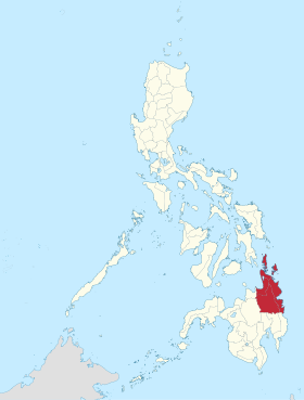
Caraga
rehiyon ed Pilipinas
Page Module:Infobox/styles.css has no content.
| Caraga | |
|---|---|
 Lokasyon na Caraga | |
 | |
| 8°55′12″N 125°30′0″E | |
| Dalin | Filipinas |
| Kabesera | Butuan |
| Barangay | 1311 |
| Kaawang | |
| • Katiponan | 21,478.35 km2 (8,292.84 sq mi) |
| Bilang na too (Mayo 1, 2020)[1] | |
| • Katiponan | 2,804,788 |
| • Densidad | 130/km2 (340/sq mi) |
Say Caraga et rehiyon na Filipinas. Unong ed 1 Mayo 2020 census, say populasyon to et 2,804,788 totoo tan 565,495 abong. Walay kabaleg tan sukat to ya 21,478.35 sq. km.
Saray luyag, siyudad
dumaen- Agusan ed Baybay
- Agusan ed Abalaten
- Saray isla ed Dinagât
- Surigao ed Baybay
- Surigao del Sur
- Butuan
Demograpiko
dumaen| Taon | Pop. | ±% p.a. |
|---|---|---|
| 1903 | 115,112 | — |
| 1918 | 166,904 | +2.51% |
| 1939 | 324,918 | +3.22% |
| 1948 | 391,400 | +2.09% |
| 1960 | 631,007 | +4.06% |
| 1970 | 950,129 | +4.17% |
| 1975 | 1,114,336 | +3.25% |
| 1980 | 1,371,512 | +4.24% |
| 1990 | 1,764,297 | +2.55% |
| 1995 | 1,942,687 | +1.82% |
| 2000 | 2,095,367 | +1.64% |
| 2007 | 2,293,346 | +1.25% |
| 2010 | 2,429,224 | +2.12% |
| 2015 | 2,596,709 | +1.28% |
| 2020 | 2,804,788 | +1.53% |
| Reperensiya: Philippine Statistics Authority[2][3][4] | ||
Saray reperensiya
dumaen- ↑ "2020 Census of Population and Housing (2020 CPH) Population Counts Declared Official by the President". Hulyo 7, 2021. https://psa.gov.ph/content/2020-census-population-and-housing-2020-cph-population-counts-declared-official-president.
- ↑ Census of Population (2015). "Caraga". Total Population by Province, City, Municipality and Barangay. PSA. Retrieved 29 June 2016.
- ↑ Census of Population and Housing (2010). "Caraga". Total Population by Province, City, Municipality and Barangay. NSO. Retrieved 29 June 2016.
- ↑ Censuses of Population (1903–2007). "Caraga". Table 1. Population Enumerated in Various Censuses by Province/Highly Urbanized City: 1903 to 2007. NSO.