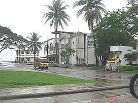
Baybay
Siyudad na Pilipinas ed luyag na Leyte
Say Baybay et unaan ya klase ya baley ed luyag na Leyte, Filipinas. Unong ed 1 Mayo 2020 census, say populasyon to et 111,848 totoo tan 28,135 abong. Walay kabaleg tan sukat to ya 459.30 sq. km. Say zip code to et 6521.
| Baybay | |
|---|---|
| Siyudad | |
 | |
 Lokasyon na Baybay | |
 | |
| 10°40′48″N 124°48′0″E | |
| Dalin | Filipinas |
| Angipaletnegan | 1620 |
| Barangay | 92 |
| Kaawang | |
| • Katiponan | 459.30 km2 (177.34 sq mi) |
| Elebasyon | 147 m (482 ft) |
| Bilang na too (Mayo 1, 2020)[1] | |
| • Katiponan | 111,848 |
| • Densidad | 240/km2 (630/sq mi) |
| Economia | |
| • Clase | unaan ya klase ya baley |
| • Ingresos | ₱1,101,259,103.24 (2020) |
| • Activos | ₱4,072,953,031.37 (2020) |
| • Pasivos | ₱550,319,552.04 (2020) |
| • Gastos | ₱673,745,522.59 (2020) |
| Kodigo na postal | 6521 |
| Kodigo na lugar | 53 |
| Website |
baybaycity |
Saray barangay
dumaen- Altavista
- Ambacan
- Amguhan
- Ampihanon
- Balao
- Banahao
- Biasong
- Bidlinan
- Bitanhuan
- Bubon
- Buenavista
- Bunga
- Butigan
- Kabatuan
- Caridad
- Ga-as
- Gabas
- Gakat
- Guadalupe (Utod)
- Gubang
- Hibunawan
- Higuloan
- Hilapnitan
- Hipusngo
- Igang
- Imelda
- Jaena
- Kabalasan
- Kabungaan
- Kagumay
- Kambonggan
- Candadam
- Kan-ipa
- Kansungka
- Kantagnos
- Kilim
- Lintaon
- Maganhan
- Mahayahay
- Mailhi
- Maitum
- Makinhas
- Mapgap
- Marcos (Kab-kab)
- Maslug
- Matam-is
- Maybog
- Maypatag
- Monterico
- Palhi
- Pangasungan
- Pansagan
- Patag
- Plaridel
- Poblacion Zone 2
- Poblacion Zone 3
- Poblacion Zone 4
- Poblacion Zone 5
- Poblacion Zone 6
- Poblacion Zone 7
- Poblacion Zone 8
- Poblacion Zone 9
- Poblacion Zone 10
- Poblacion Zone 11
- Poblacion Zone 12
- Poblacion Zone 13
- Poblacion Zone 14
- Poblacion Zone 15
- Poblacion Zone 16
- Poblacion Zone 17
- Poblacion Zone 18
- Poblacion Zone 19
- Poblacion Zone 20
- Poblacion Zone 21
- Poblacion Zone 22
- Poblacion Zone 23
- Pomponan
- Punta
- Sabang
- San Agustin
- San Isidro
- San Juan
- Santa Cruz
- Santo Rosario
- Sapa
- Ciabo
- Villa Solidaridad
- Zacarito
- Poblacion Zone 1
- Cogon
- Monte Verde
- Villa Mag-aso
- Visca
- Farmer's village
Demograpiko
dumaen| Taon | Pop. | ±% p.a. |
|---|---|---|
| 1903 | 22,990 | — |
| 1918 | 36,917 | +3.21% |
| 1939 | 42,526 | +0.68% |
| 1948 | 50,725 | +1.98% |
| 1960 | 51,799 | +0.17% |
| 1970 | 63,782 | +2.10% |
| 1975 | 67,031 | +1.00% |
| 1980 | 74,640 | +2.17% |
| 1990 | 82,281 | +0.98% |
| 1995 | 86,179 | +0.87% |
| 2000 | 95,630 | +2.26% |
| 2007 | 102,526 | +0.96% |
| 2010 | 102,841 | +0.11% |
| 2015 | 109,432 | +1.19% |
| 2020 | 111,848 | +0.43% |
| Reperensiya: Philippine Statistics Authority[2][3][4] | ||
Saray reperensiya
dumaen- ↑ "2020 Census of Population and Housing (2020 CPH) Population Counts Declared Official by the President". Hulyo 7, 2021. https://psa.gov.ph/content/2020-census-population-and-housing-2020-cph-population-counts-declared-official-president.
- ↑ Census of Population (2015). "Region VIII (Eastern Visayas)". Total Population by Province, City, Municipality and Barangay. PSA. Retrieved 29 June 2016.
- ↑ Census of Population and Housing (2010). "Region VIII (Eastern Visayas)". Total Population by Province, City, Municipality and Barangay. NSO. Retrieved 29 June 2016.
- ↑ Censuses of Population (1903–2007). "Region VIII (Eastern Visayas)". Table 1. Population Enumerated in Various Censuses by Province/Highly Urbanized City: 1903 to 2007. NSO.